0 Cart
Added to Cart
    You have items in your cart
    You have 1 item in your cart
    Total
    Check Out Continue Shopping

    News

    London Postcode Maps


    Our new London Postcode Maps website is now online!

    As we get many enquiries for Postcode reference data, maps and books for London we thought it may be easier to dedicate a site to the subject. So the new site includes a whole range of products and materials including:

    - Postcode wall maps
    - Postcode map images
    - London Guides which include Postcode information
    - Postcode data and spread sheets
    - Postcode boundaries for London
    - A-Z maps showing Postcodes
    - And some freebies...!

    So have a look at the new site and tell us what you think - all suggestions for information or products you think would be useful aadditions to the site are warmly welcome.

    Read more

    Postcode Address Data Update

    The latest update to the UKs official Postcode address database is now available so we thought it worthwhile to review exactly what the Postcode Address File (PAF®) is and what it can do for businesses.

    The Postcode Address File from Royal Mail is the essential database of UK addresses. PAF® can provide significant costs savings to any business by reducing the amount of time taken to capture customer addresses either over the phone or via your website. Additional benefits of streamlined address entry are increased customer satisfaction and reduced web purchase abandonments.

    As the only complete source of UK addresses and Postcodes, PAF® also ensures you get the address right first time – essential for correct mail delivery and protecting your business’ professional image to aid customer retention.

    Correcting address spelling mistakes and formatting errors can also be very time consuming and costly if attempted after the event.

    PAF® also helps you sort your mail with a full list of correct Postcodes, helping to reduce your postage costs with various Royal Mail services such as Mailsort®, Presstream® and Cleanmail®. Postage costs can further be reduced by improving or removing poor quality addresses by comparison to the national address database.

    Whatever the nature of your business, whether you despatch products to your customers or communicate with them via direct mail, you need PAF® to do it efficiently and professionally.

    The latest update of PAF incorporates over 50,000 changes to delivery points (addresses) and over 3,000 Postcode changes including nearly 2,000 new Postcodes and over 1,000 Large user Postcodes deleted. As Large user Postcodes are predominantly used by businesses receiving high volumes of mail we wonder whether the reduction of large user Postcodes is a sign of the struggling economy?

    For more information on PAF please visit our national address data product page


    Read more

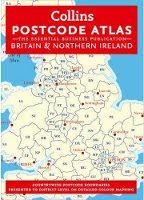
    Postcode Map Atlas Released

    The latest release of the best selling Postcode District Atlas of the UK is out now...

    This 224 page essential Postcode reference book clearly shows Postcode District boundaries for the whole country on detailed colour mapping. In Central London additional detail is provided with Postcode Sector boundaries.

    Busy conurbations are shown at a larger scale and all Postcode and administrative boundaries reflect the latest changes at the time of going to press.

    With full indexes to place names and Postcode Atlas is one of the most popular Postcode mapping products in the market.

    The normal retail price for this Atlas is £50 but we have shopped around and found it much cheaper from Amazon. Click here to view the Atlas.

    Read more

    Save 25% on Postcode Lookup Data

    New Product Offer - Save £50

    Find the Constituency and MP Name for any UK Postcode

    Due to increasing demand, we have just replaced the hugely popular Postcode to Parliamentary Constituency Lookup database with an improved version which now includes the name of the MP who holds the seat and the party they represent.

    As a result, you can now search for any UK Postcode and immediately determine the constituency it falls within along with the MP and party holding the seat. This is a major enhancement which we know will be of great value to any organisation that needs to relate Postcodes or addresses to political geography.

    The cost of this new database is £175 plus VAT for use on a single PC but we are offering a £50 discount on all orders placed before 30th November. To apply your discount simply visit the product page and enter the discount code MPNOFFER when checking out and apply the saving. A link to download the new database will be emailed to you immediately once your order has been received.

    Please note: This offer expires on 30th November 2011

    Best Wishes

    Map-Logic

    Read more

    Latest Postcode Data Releases

    The October release of Postcode data is out now containing lookup and reference files for Postcodes to various other UK geographies in addition to location based data files such as the Postcode to Grid Reference database.

    All data files are processed from official information sources and compiled so that they are ready to use in your chosed database or spreadsheet software.

    To celebrate this release, we are offering a 25% discount to all data purchases before the end of October. Simply choose your required database from the list of available products and enter the following voucher code when checking out: ODU1125


    Read more