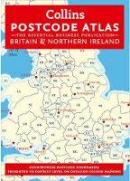
Postcode Map Atlas Released
The latest release of the best selling Postcode District Atlas of the UK is out now...
 This 224 page essential Postcode reference book clearly shows Postcode District boundaries for the whole country on detailed colour mapping. In Central London additional detail is provided with Postcode Sector boundaries.
Busy conurbations are shown at a larger scale and all Postcode and administrative boundaries reflect the latest changes at the time of going to press.
With full indexes to place names and Postcode Atlas is one of the most popular Postcode mapping products in the market.
The normal retail price for this Atlas is £50 but we have shopped around and found it much cheaper from Amazon. Click here to view the Atlas.
